
Kimanis–Keningau Highway
Overview
The Kimanis–Keningau Highway is a vital roadway in Sabah, Malaysia, connecting the southwestern town of Kimanis to the inland district of Keningau. Spanning approximately 66 km, the highway was completed in the early 2000s and is operated by the Malaysian Public Works Department (JKR). This highway plays a crucial role in linking agricultural, industrial, and tourism hubs, improving both logistics and travel across the West Coast and Interior regions of Sabah.
Route Overview
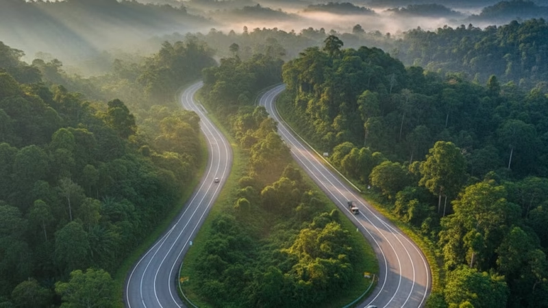
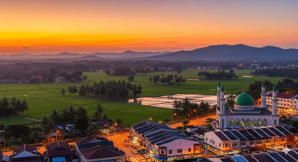
The highway runs in a southwest–northeast direction, beginning at Kimanis near the West Coast Highway (E1) and ending at Keningau, where it intersects with the Interior North–South Road. Along the way, the highway passes through rolling hills, scenic valleys, and dense forests, offering travelers a mix of rural landscapes and mountain views. Key milestones include Sipitang, Tenom, and smaller villages that dot the interior regions of Sabah.
Key Cities and Exits
Major towns and interchanges along the Kimanis–Keningau Highway include:
- Kimanis: Starting point, connecting to the West Coast Highway.
- Sipitang: A growing town with food outlets and fuel stations.
- Tenom: Known for its coffee plantations and cultural sites.
- Keningau: Inland terminus connecting to the Interior North–South Road.
Each exit provides access to local attractions, markets, and secondary roads leading to plantations and eco-tourism spots.
Scenic Highlights
Travelers along this highway are treated to Sabah’s natural beauty:
- Mountains and valleys: The route passes near the Crocker Range, offering elevated views.
- Agricultural landscapes: Rolling coffee and palm oil plantations are visible along certain stretches.
- Rivers and forests: The highway crosses several rivers and meanders through dense greenery, making it ideal for photography stops.
- Cultural landmarks: Small towns along the route showcase traditional Sabah architecture and heritage.
Rest & Service Areas (R&R)
While this highway does not feature large-scale R&R complexes, drivers can stop at:
- Sipitang Rest Stop: Petrol station, mini-mart, and food stalls.
- Tenom Service Area: Cafeteria, toilets, prayer room, and fuel station.
These areas provide essential amenities for long-distance travelers. Travelers are encouraged to plan fuel stops ahead, as stretches between towns can be sparsely serviced.
Toll Information
The Kimanis–Keningau Highway currently operates as a toll-free route, making it accessible to all drivers without additional charges. Travelers can expect straightforward access with standard highway regulations.
Safety & Facilities
- Patrols: The highway is monitored by the Malaysian Public Works Department and local police patrols.
- Speed Limits: Standard speed limits vary between 70–90 km/h depending on terrain and road curvature.
- Emergency Facilities: Limited emergency lanes exist in hilly sections. Drivers are advised to carry basic breakdown equipment.
Useful Apps & Resources
- Waze and Google Maps: Real-time navigation and traffic updates.
- JKR Sabah website: Road conditions and maintenance schedules.
- Emergency hotline: Contact local police (999) in case of accidents.
Travel Tips
- Best travel time: Morning hours are recommended to enjoy scenic views and avoid afternoon haze or rain.
- Driving etiquette: Maintain safe distances, especially on winding stretches.
- Planning: Ensure vehicle fuel is sufficient for longer stretches between service areas.
Connecting Expressways
The Kimanis–Keningau Highway links with:
- West Coast Highway (E1) at Kimanis.
- Interior North–South Road at Keningau.
- Secondary roads connecting plantations, villages, and eco-tourism spots.
Summary Table
| Feature | Details |
|---|---|
| Expressway Name | Kimanis–Keningau Highway |
| Code | – |
| Total Length | 66 km |
| Operator | JKR Sabah |
| Start & End Points | Kimanis – Keningau |
| States Covered | Sabah |
| Average Speed Limit | 70–90 km/h |
| Toll Type | Toll-free |
Conclusion
The Kimanis–Keningau Highway is an essential transport link in Sabah, connecting the West Coast to the interior regions efficiently. Its scenic landscapes, practical access to key towns, and toll-free system make it a preferred choice for both locals and tourists. Beyond improving travel and logistics, the highway showcases Sabah’s natural and cultural beauty, making journeys along this route both practical and memorable.
| Road Name | Road Short Name | Code | Main Route |
|---|---|---|---|
| North–South Expressway (PLUS) | North–South Expressway | PLUS / E1, E2 | Bukit Kayu Hitam – Johor Bahru |
| North–South Expressway Central Link | ELITE Expressway | E6 | Shah Alam – Nilai North |
| New Klang Valley Expressway | NKVE | E1 | Kuala Lumpur – Klang |
| Federal Highway | Federal Highway | E5 | Kuala Lumpur – Klang |
| Damansara–Puchong Expressway | LDP | E11 | Damansara – Puchong |
| Shah Alam Expressway | KESAS | E5 | Sri Petaling – Pandamaran |
| New Pantai Expressway | NPE | E10 | Subang – Bangsar |
| Maju Expressway | MEX | E20 | Kuala Lumpur – Putrajaya |
| Kajang Dispersal Link | SILK | E18 | Kajang – Semenyih |
| Kajang–Seremban Highway | LEKAS | E21 | Kajang – Seremban |
| South Klang Valley Expressway | SKVE | E26 | Pulau Indah – Kajang |
| Guthrie Corridor Expressway | GCE | E35 | Shah Alam – Rawang |
| Kuala Lumpur–Karak Expressway | KLK | E8 | Gombak – Karak |
| East Coast Expressway Phase 1 | LPT1 | E8 | Karak – Kuantan |
| East Coast Expressway Phase 2 | LPT2 | E8 | Kuantan – Kuala Nerus |
| Butterworth–Kulim Expressway | BKE | E15 | Butterworth – Kulim |
| Penang Bridge | Penang Bridge | E36 | Gelugor – Perai |
| Sultan Abdul Halim Muadzam Shah Bridge | Second Penang Bridge | E28 | Batu Maung – Batu Kawan |
| Johor Bahru Eastern Dispersal Link | EDL | E14 | Pandan – CIQ Johor |
| Senai–Desaru Expressway | SDE | E22 | Senai – Desaru |
| Second Link Expressway | Linkedua | E3 | Senai – Tuas (Singapore) |
| Kuala Lumpur–Seremban Expressway | KL–Seremban | E37 | Kuala Lumpur – Seremban |
| Cheras–Kajang Expressway | Grand Saga | E7 | Cheras – Kajang |
| Kuala Lumpur–Putrajaya Expressway | MEX | E20 | KL – Putrajaya – KLIA |
| West Coast Expressway | WCE | E32 | Taiping – Banting |
| Central Spine Road | CSR | – | Bentong – Kuala Krai |
| Federal Route 1 | Federal Route 1 | FT1 | Bukit Kayu Hitam – Johor Bahru |
| Federal Route 2 | Federal Route 2 | FT2 | Port Klang – Kuantan |
| Federal Route 3 | Federal Route 3 | FT3 | Johor Bahru – Rantau Panjang |
| Federal Route 4 | Federal Route 4 | FT4 | Gerik – Jeli |
| Federal Route 5 | Federal Route 5 | FT5 | Ipoh – Johor Bahru |
| Federal Route 8 | Federal Route 8 | FT8 | Kuala Lumpur – Kota Bharu |
| Federal Route 9 | Federal Route 9 | FT9 | Karak – Tampin |
| Federal Route 10 | Federal Route 10 | FT10 | Temerloh – Gemas |
| Federal Route 24 | Federal Route 24 | FT24 | Muar – Yong Peng |
| Federal Route 50 | Federal Route 50 | FT50 | Batu Pahat – Kluang – Jemaluang |
| Federal Route 51 | Federal Route 51 | FT51 | Melaka City – Alor Gajah |
| Federal Route 54 | Federal Route 54 | FT54 | Kuala Lumpur – Kuala Selangor |
| Federal Route 76 | Federal Route 76 | FT76 | Kuala Kangsar – Baling – Kulim |
| Federal Route 67 | Federal Route 67 | FT67 | Sungai Petani – Kuala Ketil |
| Pan Borneo Highway (Sabah) | Pan Borneo Sabah | AH150 / PBHS | Kota Kinabalu – Tawau |
| Kimanis–Keningau Highway | Kimanis–Keningau Road | – | Kimanis – Keningau |
| Kota Belud–Ranau Road | Kota Belud–Ranau | – | Coastal – Interior link |
| Pan Borneo Highway (Sarawak) | Pan Borneo Sarawak | AH150 / PBHS | Telok Melano – Miri |
| Kuching–Serian Road | Kuching–Serian | – | Kuching – Serian |
| Bintulu–Miri Coastal Road | Bintulu–Miri Coastal | – | Bintulu – Miri |
| Kota Bharu–Kuala Krai Expressway | KBKK Expressway | KBKK | Kota Bharu – Kuala Krai |
| Pan Borneo Highway (Overall) | Pan Borneo Highway | PBH | Across Sabah & Sarawak |


Comments are closed.