
Bintulu–Miri Coastal Road
Overview
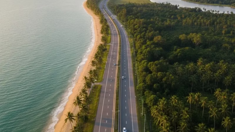
The Bintulu–Miri Coastal Road is a vital highway along the northern coastline of Sarawak, Malaysia, connecting the towns of Bintulu and Miri. Stretching over approximately 200 kilometers, this scenic route plays a critical role in facilitating trade, tourism, and local commuting in the region. Completed in the early 2000s, the road is managed by the Sarawak Public Works Department (JKR) and serves as a crucial link between industrial zones, oil and gas facilities, and urban centers in northern Sarawak. Its strategic location along the coast also makes it a favorite route for travelers seeking coastal views and access to natural attractions.
Route Overview
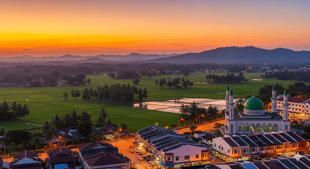
Running in an east–west direction, the Bintulu–Miri Coastal Road follows the coastline of Sarawak, offering drivers both functional connectivity and scenic experiences. While the highway does not fall under the national expressway numbering system, it connects seamlessly to federal and state roads. Starting from Bintulu in the south, it heads northward along the coast before terminating in Miri, linking various towns, industrial areas, and tourism hotspots along the way. Key route milestones include passing through Sebauh, Niah, Bekenu, and other coastal settlements.
Key Cities and Exits
The highway serves several towns and important junctions:
- Bintulu – Starting point with connections to Bintulu Port and Tanjung Kidurong industrial area.
- Sebauh – Access to local markets and small-scale industrial zones.
- Niah – Gateway to the Niah Caves National Park, a UNESCO heritage site.
- Bekenu – Coastal town with access to beaches and seafood markets.
- Miri – Northern terminus; connects to the Miri–Baram Road and other regional routes leading to Brunei.
Scenic Highlights
The Bintulu–Miri Coastal Road is renowned for its coastal and natural scenery:
- Coastal Views – The highway often runs close to the South China Sea, offering picturesque seascapes.
- Rainforest Surroundings – Travelers pass through lush tropical forests with glimpses of Sarawak’s diverse flora and fauna.
- Niah Caves – A historic limestone cave system that adds cultural value to the journey.
- Plantations and Rural Villages – Rolling palm oil and sago plantations provide a unique glimpse of rural Sarawak life.
Rest & Service Areas (R&R)
While not featuring large-scale expressway R&R facilities, several stopping points and small eateries along the route provide essential services:
- Bintulu R&R – Fuel stations, toilets, prayer rooms, and local food stalls.
- Sebauh Stopovers – Small rest areas with petrol stations and convenience stores.
- Bekenu Coastal Stop – Ideal for refreshments with scenic ocean views.
- Miri Termination Area – Multiple petrol stations, food courts, and access to emergency services.
Toll Information
The Bintulu–Miri Coastal Road is toll-free, making it an accessible and cost-effective route for both locals and tourists.
Safety & Facilities
Safety on the highway is supported by standard measures:
- Speed Limits – Typically 80–90 km/h in rural areas, reduced near towns.
- Lane Details – Two-lane undivided highway with occasional passing lanes.
- Patrol & Emergency Services – Local police patrols and emergency hotlines are available.
- Breakdown Services – Roadside assistance can be contacted via JKR and local tow services.
Useful Apps & Resources
Travelers can make use of these tools for navigation and updates:
- Google Maps & Waze – Live traffic updates.
- JKR Sarawak Website – Road maintenance and emergency announcements.
- Local Police Hotlines – For accidents or emergency assistance.
Travel Tips
- Best Travel Times – Early mornings or late afternoons to avoid traffic near Bintulu and Miri.
- Driving Tips – Watch for sharp curves along coastal stretches; maintain caution in wet conditions.
- Planning Advice – Keep fuel topped up; some rural stretches have limited services.
Connecting Expressways
The Bintulu–Miri Coastal Road links to several important regional routes:
- Miri–Baram Road – Provides access to northern Sarawak and Brunei.
- Bintulu–Tatau Road – Connects inland towns and industrial areas.
- Sebauh–Belaga Road – Leads to the interior of Sarawak.
Summary Table
| Feature | Details |
|---|---|
| Expressway Name | Bintulu–Miri Coastal Road |
| Code | N/A |
| Total Length | ~200 km |
| Operator | Sarawak Public Works Department (JKR) |
| Start & End Points | Bintulu – Miri |
| States Covered | Sarawak |
| Average Speed Limit | 80–90 km/h |
| Toll Type | Toll-free |
Conclusion
The Bintulu–Miri Coastal Road is a vital artery for northern Sarawak, enhancing both connectivity and regional development. It not only supports trade and logistics but also provides travelers with scenic views, cultural landmarks, and convenient access to towns and natural attractions. This coastal route remains an essential part of Sarawak’s transport network, enriching both local life and tourism.
| Road Name | Road Short Name | Code | Main Route |
|---|---|---|---|
| North–South Expressway (PLUS) | North–South Expressway | PLUS / E1, E2 | Bukit Kayu Hitam – Johor Bahru |
| North–South Expressway Central Link | ELITE Expressway | E6 | Shah Alam – Nilai North |
| New Klang Valley Expressway | NKVE | E1 | Kuala Lumpur – Klang |
| Federal Highway | Federal Highway | E5 | Kuala Lumpur – Klang |
| Damansara–Puchong Expressway | LDP | E11 | Damansara – Puchong |
| Shah Alam Expressway | KESAS | E5 | Sri Petaling – Pandamaran |
| New Pantai Expressway | NPE | E10 | Subang – Bangsar |
| Maju Expressway | MEX | E20 | Kuala Lumpur – Putrajaya |
| Kajang Dispersal Link | SILK | E18 | Kajang – Semenyih |
| Kajang–Seremban Highway | LEKAS | E21 | Kajang – Seremban |
| South Klang Valley Expressway | SKVE | E26 | Pulau Indah – Kajang |
| Guthrie Corridor Expressway | GCE | E35 | Shah Alam – Rawang |
| Kuala Lumpur–Karak Expressway | KLK | E8 | Gombak – Karak |
| East Coast Expressway Phase 1 | LPT1 | E8 | Karak – Kuantan |
| East Coast Expressway Phase 2 | LPT2 | E8 | Kuantan – Kuala Nerus |
| Butterworth–Kulim Expressway | BKE | E15 | Butterworth – Kulim |
| Penang Bridge | Penang Bridge | E36 | Gelugor – Perai |
| Sultan Abdul Halim Muadzam Shah Bridge | Second Penang Bridge | E28 | Batu Maung – Batu Kawan |
| Johor Bahru Eastern Dispersal Link | EDL | E14 | Pandan – CIQ Johor |
| Senai–Desaru Expressway | SDE | E22 | Senai – Desaru |
| Second Link Expressway | Linkedua | E3 | Senai – Tuas (Singapore) |
| Kuala Lumpur–Seremban Expressway | KL–Seremban | E37 | Kuala Lumpur – Seremban |
| Cheras–Kajang Expressway | Grand Saga | E7 | Cheras – Kajang |
| Kuala Lumpur–Putrajaya Expressway | MEX | E20 | KL – Putrajaya – KLIA |
| West Coast Expressway | WCE | E32 | Taiping – Banting |
| Central Spine Road | CSR | – | Bentong – Kuala Krai |
| Federal Route 1 | Federal Route 1 | FT1 | Bukit Kayu Hitam – Johor Bahru |
| Federal Route 2 | Federal Route 2 | FT2 | Port Klang – Kuantan |
| Federal Route 3 | Federal Route 3 | FT3 | Johor Bahru – Rantau Panjang |
| Federal Route 4 | Federal Route 4 | FT4 | Gerik – Jeli |
| Federal Route 5 | Federal Route 5 | FT5 | Ipoh – Johor Bahru |
| Federal Route 8 | Federal Route 8 | FT8 | Kuala Lumpur – Kota Bharu |
| Federal Route 9 | Federal Route 9 | FT9 | Karak – Tampin |
| Federal Route 10 | Federal Route 10 | FT10 | Temerloh – Gemas |
| Federal Route 24 | Federal Route 24 | FT24 | Muar – Yong Peng |
| Federal Route 50 | Federal Route 50 | FT50 | Batu Pahat – Kluang – Jemaluang |
| Federal Route 51 | Federal Route 51 | FT51 | Melaka City – Alor Gajah |
| Federal Route 54 | Federal Route 54 | FT54 | Kuala Lumpur – Kuala Selangor |
| Federal Route 76 | Federal Route 76 | FT76 | Kuala Kangsar – Baling – Kulim |
| Federal Route 67 | Federal Route 67 | FT67 | Sungai Petani – Kuala Ketil |
| Pan Borneo Highway (Sabah) | Pan Borneo Sabah | AH150 / PBHS | Kota Kinabalu – Tawau |
| Kimanis–Keningau Highway | Kimanis–Keningau Road | – | Kimanis – Keningau |
| Kota Belud–Ranau Road | Kota Belud–Ranau | – | Coastal – Interior link |
| Pan Borneo Highway (Sarawak) | Pan Borneo Sarawak | AH150 / PBHS | Telok Melano – Miri |
| Kuching–Serian Road | Kuching–Serian | – | Kuching – Serian |
| Bintulu–Miri Coastal Road | Bintulu–Miri Coastal | – | Bintulu – Miri |
| Kota Bharu–Kuala Krai Expressway | KBKK Expressway | KBKK | Kota Bharu – Kuala Krai |
| Pan Borneo Highway (Overall) | Pan Borneo Highway | PBH | Across Sabah & Sarawak |


Comments are closed.